Hydropower projects must be licensed by the Federal Energy Regulatory Commission (FERC), a process that can be time consuming and costly without the appropriate expertise and guidance. For facilities in complicated geographic locations, relicensing can present even more challenges.
Innovative solutions such as revising project boundaries can streamline the process, while still ensuring compliance.
The Ozark Beach Project
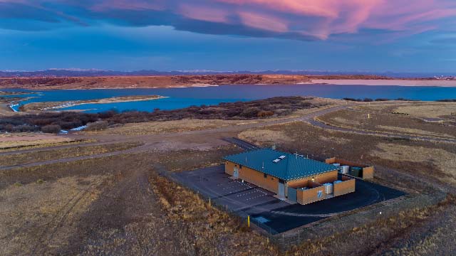
The Ozark Beach Hydroelectric Project, owned and operated by The Empire District Electric Company (EDEC), is a FERC-licensed, 16 MW run-of-river project located on the White River in south central Missouri. The project includes a 2,200-acre impoundment (Lake Taneycomo) located between two federal projects: Table Rock Dam (upstream) and Bull Shoals Reservoir (downstream). As such, the Ozark Beach Project operates in a highly dynamic system under unique and complex circumstances.
As part of the project relicensing process, EDEC proposed revising the project boundary to exclude land that is no longer required for project operation to reduce administrative costs.
The project’s existing boundary encompasses the dam, powerhouse, switchyard, transmission line and impoundment, but extends far beyond these structures. Upstream of the project dam, the existing project boundary generally conforms to the lake shoreline but in some areas includes tracts that would not reasonably be deemed necessary for current or future operation and maintenance, according to FERC guidelines. Further, development advances largely consisting of private residential structures and uses, have occurred on properties within the project area. Resolving these encroachments were likely to be less complicated if FERC jurisdiction over these lands was removed. Working in partnership with Black & Veatch, the project team collaborated to issue a contraction of the existing project boundary and the corresponding area.
Adjusting Project Boundaries
Establishing the FERC project boundary around the impoundment of a facility such as Ozark Beach can be a complicated process. Although FERC regulations instruct the applicant to use the “normal maximum surface elevation” as a basis for establishing the project boundary around an impoundment, this is not clearly defined. Applicants must use their best judgment to determine these borders. In the case of Lake Taneycomo, streamflow is heavily influenced by releases from Table Rock Dam making it difficult to identify the “normal” and “maximum” elevations.
To define the revised project boundary, the Black & Veatch and EDEC team worked together to:
- Define the maximum service elevation
- Define flow releases from Table Rock Dam
- Define horizontal limits of project boundary
- Implement modeling to establish the revised project boundary
Collaborating with FERC
Black & Veatch and EDEC professionals collaborated directly with FERC to discuss the rationale and approach to revising the Project boundary. By liaising directly with the agency, the project team was given valuable feedback to carry on with the revision knowing that they would meet compliance standards.
The revised project boundary reduced the acreage of land by 6,021 acres. This led to significant cost savings from reduced administration on FERC and EDEC on extraneous land. In addition, condensing the lands within the project boundary to only what is required for operation and maintenance minimizes future encroachment that may otherwise present potential legal challenges from land owners.
Working in partnership with a knowledgeable specialist can streamline the sometime arduous and complicated FERC relicensing process.