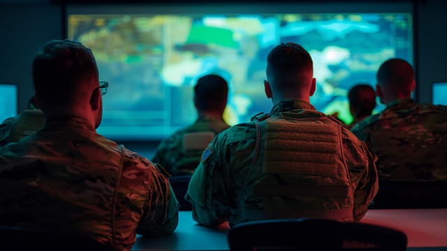
Mission readiness equips national defense agencies to rapidly assess conditions, reduce uncertainty, accelerate decisions and strengthen safety and compliance. Equally important is the ability to plan operations and maintenance (O&M) with greater confidence and safety. Achieving that level of readiness depends on decision-ready infrastructure, starting with decision-ready site data. Advanced technologies are changing what’s possible, from light detection and ranging (LiDAR) and 360-degree imagery to virtual reality design reviews and digital twins. Building information modeling (BIM) shows what an asset is and where it sits in space. A digital twin goes further by connecting that model to current information — condition, status, performance — so teams can keep learning and improving over time. When you combine them, the result is a clearer, easier way to understand complex facilities and make decisions faster. These tools make it possible to capture existing conditions quickly and create a current digital record for faster, lower-risk delivery of mission-critical infrastructure.
What’s changing in mission critical infrastructure and why it’s accelerating
The trend is away from static documentation toward reality-capture workflows that make conditions visible, shareable and measurable even without everyone on site. Driving the shift are:
LiDAR, also called 3D-laser scanning, for high-fidelity geometry used in scan-to-building information modeling (BIM) workflows.
360-degree photography for immersive, time-stamped visual context and remote walkthroughs.
Virtual reality (VR) to conduct immersive design review and coordination before construction begins.
The value of these tools compounds when integrated as one data pipeline, from capture to design to build to operate. Combined with location context through advanced geographic information systems (GIS) and performance attributes, these views can also help leaders prioritize investments, plan work and communicate risk in a way that’s easier to understand. Here’s how it comes together.
Reality capture creates verified existing conditions, while LiDAR captures existing conditions as a dense point cloud. This geometrically accurate digital representation provides context and can serve as the basis for scan-to-BIM modeling. Real-world accuracy depends on scan planning, overlap, registration and quality assurance and quality control (QA/QC). Practical outcomes are commonly on the order of several millimeters once multiple scans are combined.
Scan-to-BIM converts what’s captured into a usable model structure for design and coordination. Model accuracy depends on the quality of the underlying scan data, the specified level of detail and the modeling standards applied to the project.
Immersive design review. A VR design review improves decisions early when changes are least costly as it enables stakeholders to experience designs at real-world scale, improving spatial understanding and surfacing issues that may not be obvious in 2D reviews. This is particularly useful for O&M and safety considerations.
From reality capture to digital twins. A digital twin combines a model with living data and a clear way to keep it current, so teams can act on insights across the asset lifecycle. That makes the twin only as reliable as its starting point. Reality capture provides that defensible baseline—and the spatial context that helps teams “see” what the data means, not just read it. With that shared visual reference, teams can spot issues sooner, coordinate changes with fewer surprises and reduce rework.
By making these tools operational, owners can move from impressive visuals to mission-ready decisions supported by:
Spatially anchored information so situational awareness and confidence are greater.
A more intuitive way to access data so more stakeholders can use it without specialized skills.
Strong governance and QA/QC so teams trust what they see and act faster.
Secure, role-based sharing so collaboration increases without increasing risk.
Early operator and maintainer input so readiness extends into O&M.
The strongest programs connect visual models to the data owners already manage. The goal is to have the digital twin complement existing systems. That makes it easier to scale from a project view to a lifecycle view.
Governance matters: from cool visuals to mission critical infrastructure
Reality capture and immersive workflows create real value when they’re managed like any other engineering deliverable — with clear capture plans, validation steps and strong controls.
Capture planning and QA/QC. Point clouds need to be registered and verified. Accuracy comes from good overlap, a solid control strategy and disciplined reviews — not just the device’s stated specs.
Model governance. A BIM execution plan and ongoing model QA help keep models consistent, accurate and usable throughout the project lifecycle.
Controlled collaboration. Secure, 360‑imagery platforms let teams share site context and documentation safely with distributed stakeholders.
Where reality capture and digital twin programs can fail
The technology is powerful, yet the most frequent failure modes are well-known and predictable.
The wrong tool for the job. Reality capture includes multiple modalities, and outcomes depend on selecting the right approach for time, scale and intent.
Data is captured but isn’t usable. Point clouds can be large. Workflows can be poorly documented. Specialized processing can limit adoption. Teams may struggle to view or navigate the data without the right platform and training.
“Scanner accuracy” is mistaken for “project accuracy.” Without disciplined registration and QA/QC, overconfidence is possible and can lead to costly rework.
The twin becomes a one-time model, not a lifecycle capability. Digital twins fail when organizations don’t align governance, roles and business processes with technology, though the visuals might be impressive.
The goal: Build the program around repeatable capture standards, validation gates, controlled access and operator-focused review cycles. This keeps the data trustworthy, secure and actionable.
Reality capture, 360-degree photography, scan-to-BIM and VR design review are foundational to faster, safer, predictable delivery and sustained value in mission critical infrastructure, especially when paired with the governance needed to trust the results. Want to know more?